


Implementing Effective Forest Management Plans: Strategies for Sustainable Environmental Conservation
/In a world grappling with the consequences of climate change, the urgent need to protect and preserve our planet's natural resources has reached unprecedented levels. Among these vital resources, forests stand as true lifelines, encompassing a wealth of biodiversity, regulating climate patterns, and supporting countless communities worldwide. However, preserving these invaluable ecosystems requires more than just good intentions. It demands a proactive approach that integrates careful planning, diligent management, and a long-term vision for sustainability. Enter forest management plans — the cornerstone of responsible stewardship that seeks to strike a delicate balance between human needs and the preservation of our planet's green guardians.
Forest management plans offer comprehensive frameworks for conservation, outlining strategies to ensure the sustainable use and protection of forested areas. These plans take into account the intricate interplay between ecological, economic, and social factors, aligning the interests of both present and future generations. By integrating scientific knowledge, community engagement, and adaptive practices, these plans enable the optimal management of forest resources while safeguarding their integrity for the benefit of all. With deforestation rates soaring and habitat loss threatening countless species, well-designed forest management plan & implementation has become imperative to mitigate these detrimental effects.
Understanding the Forest Ecosystem
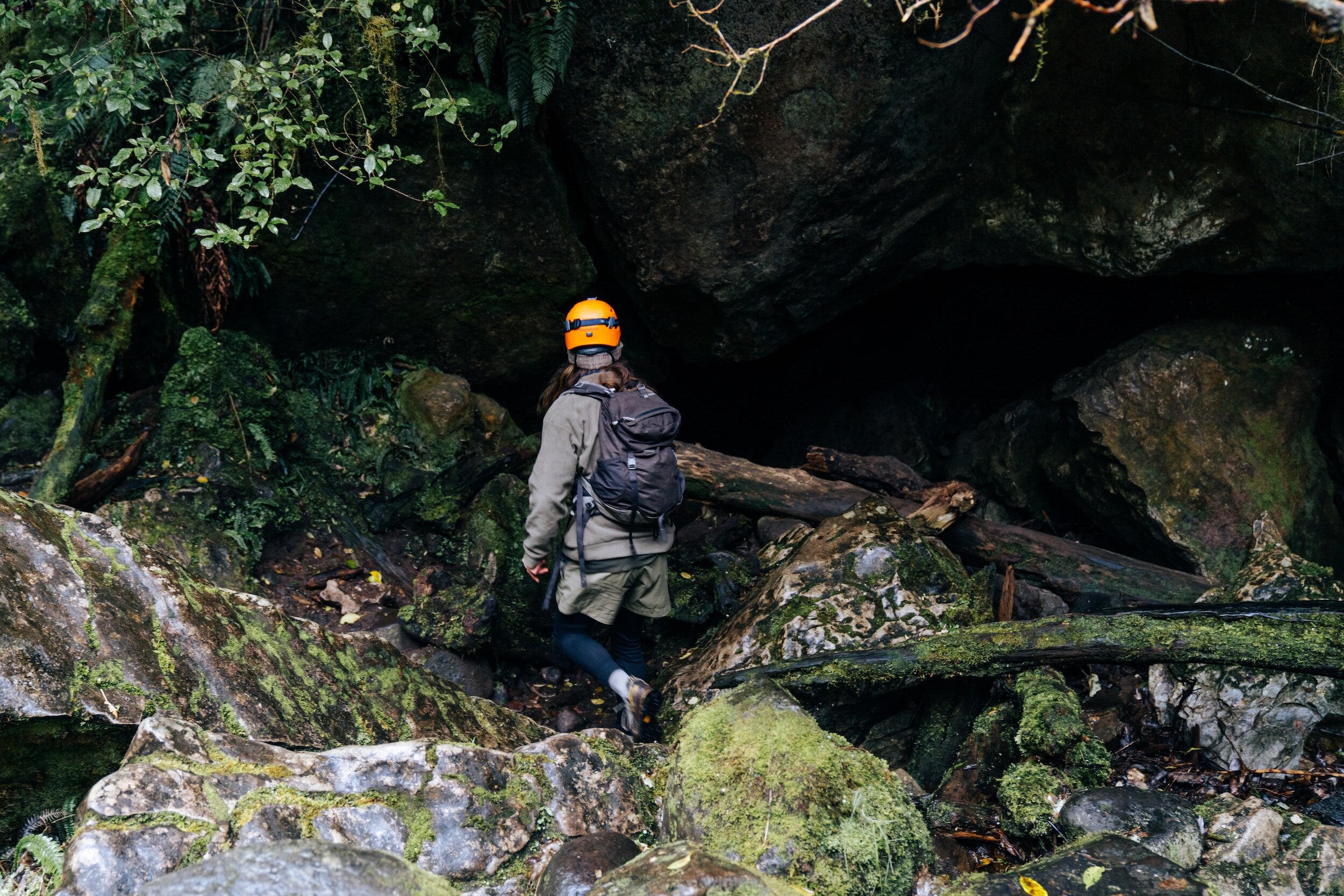
A forest ecosystem is a complex and interconnected web of living organisms and their physical environment. It consists of several essential components that work together to sustain life and maintain ecological balance.
Trees are the defining feature of forests, forming the canopy that provides shade, shelter, and food for various organisms. They play a vital role in the water cycle, absorbing and transpiring vast amounts of water, while also storing carbon dioxide through photosynthesis.

Underneath the forest canopy, a diverse array of understory plants thrive. These include shrubs, herbs, ferns, mosses, and fungi. Understory plants contribute to soil stabilization and nutrient cycling, and provide habitats for smaller organisms.
Forests are home to a rich diversity of wildlife, including mammals, birds, reptiles, amphibians, and insects. Each species occupies a specific ecological niche, fulfilling important roles such as pollination, seed dispersal, herbivory, and predator-prey interactions. Wildlife also contributes to the overall biodiversity and genetic resilience of the forest ecosystem.
Forest soils are a crucial component, supporting the growth and vitality of trees and plants. They are a dynamic mixture of organic matter, minerals, water, air, and microorganisms. Forest soils facilitate nutrient cycling and water filtration, and provide habitat for countless soil organisms, including bacteria, fungi, insects, and worms.
The components of a forest ecosystem are intricately interdependent, relying on each other for survival and functioning. Trees provide shade and shelter to understory plants, which, in turn, help regulate temperature, reduce soil erosion, and contribute to nutrient cycling through leaf litter decomposition. Some understory plants also engage in symbiotic relationships with trees, such as mycorrhizal associations, where fungi facilitate nutrient absorption for both parties.
Assessing Forest Conditions and Resources
Accurately assessing forest conditions is vital for effective forest management and conservation efforts. It involves gathering comprehensive data on various aspects, including tree species composition, density, health, biodiversity, and ecological dynamics. Several methods and technologies are employed to obtain reliable information, ensuring informed decision-making and the formulation of effective management plans. Three key methods commonly used for assessing forest conditions are remote sensing, field surveys, and data analysis.
Remote sensing involves the use of satellite or airborne sensors to collect data about the Earth's surface from a distance. It provides valuable information on forest cover, land use changes, vegetation indices, and forest health indicators. Satellite imagery allows for large-scale monitoring, capturing the spatial extent and patterns of forests over time.
Field surveys involve direct observations and measurements conducted on-site. They provide detailed and ground-truthed information about specific forest areas. Field surveys may include plot-based inventories, where sample areas are established to record tree species, diameter at breast height, tree height, and other relevant parameters.
Data analysis involves processing and interpreting the collected information to derive meaningful insights. It helps assess forest health, identify areas at risk, quantify ecosystem services, and evaluate the effectiveness of management interventions. It enables forest managers and policymakers to make informed decisions based on scientific evidence and prioritize conservation actions.
Gathering accurate and up-to-date information on forest resources is essential for several reasons:
Effective Decision-Making: Accurate information forms the foundation for making informed decisions regarding forest management, conservation, and restoration.
Monitoring and Early Warning Systems: By detecting early warning signs of degradation, such as declining tree health or increased deforestation rates, prompt action can be taken to mitigate further damage and prevent irreversible loss.
Conservation Planning: Accurate data on tree species composition, density, and health helps identify priority areas for protection, establish protected areas and corridors, and develop strategies for preserving biodiversity and rare species.
Sustainable Resource Management: Accurate information enables sustainable resource management by providing insights into timber stock, carbon sequestration potential, and other ecosystem services.
Technological advancements, such as Geographic Information Systems (GIS) and satellite imagery, play a pivotal role in gathering comprehensive forest data. GIS integrates various spatial datasets, allowing for the visualization, analysis, and interpretation of complex forest information. It aids in mapping forest cover, identifying land-use changes, and assessing the spatial distribution of different forest components.
Satellite imagery provides a wide-scale view of forests, capturing changes in forest cover, deforestation, and forest fragmentation. High-resolution satellite imagery can identify tree species and monitor forest health indicators, such as vegetation indices or anomalies. Combined with advanced image processing techniques, satellite imagery contributes to comprehensive forest assessments, supporting accurate decision-making and policy formulation.
The Importance of Multifunctional and Sustainable Forest Management
Forests are not only critical for preserving biodiversity and mitigating climate change but also serve as invaluable sources of livelihoods, water resources, and cultural heritage. Sustainable forest management aims to ensure that these multifaceted functions are harmoniously integrated, optimizing the benefits provided by forests while safeguarding their long-term health and integrity. By adopting sustainable practices, such as selective logging, reforestation, and conservation measures, we can strike a delicate balance between meeting present needs and preserving forest ecosystems for future generations. Moreover, embracing the multifunctionality of forests acknowledges their diverse roles in supporting livelihoods, providing clean water, mitigating natural hazards, and fostering cultural and spiritual connections. Sustainable and multifunctional forest management is an essential pathway towards achieving the intertwined goals of environmental conservation, social equity, and economic well-being, leading us towards a sustainable and prosperous future.
Forest Management with Satellite Technologies
Continuous monitoring and evaluation of forest management plans are vital to ensure their effectiveness, adaptability, and accountability. Forest ecosystems are dynamic and subject to various pressures, including clim*ate change, land-use changes, and illegal activities. Monitoring allows us to track the progress of management interventions, assess the health and condition of forests, and identify potential risks or shortcomings in the implementation of the plans. Regular evaluation provides opportunities for learning, adjustment, and improvement, ensuring that forest management practices align with evolving scientific knowledge, technological advancements, and societal needs.

Technology, particularly satellite analytics, plays a crucial role in monitoring forest conditions and detecting illegal activities. Satellite imagery offers a bird's-eye view of large forested areas, enabling the detection of changes in forest cover, deforestation, and forest degradation. Through the analysis of satellite data, including high-resolution imagery and advanced remote sensing techniques, it becomes possible to identify illegal logging, encroachment, and land-use conflicts.
Satellite analytics also contribute to the detection and monitoring of forest fires, allowing for rapid response and mitigation efforts. By utilizing algorithms and machine learning techniques, satellite imagery can detect changes in vegetation health and identify areas at high risk of fire outbreaks. This information helps authorities and forest managers prioritize fire prevention measures and allocate resources effectively.
In the context of combating illegal activities, technology plays a crucial role in enhancing forest law enforcement and addressing issues related to illegal logging and poaching. Satellite analytics, combined with advanced image processing and artificial intelligence algorithms, can help detect and track illegal logging activities by identifying changes in forest cover and patterns of deforestation.
Technology, particularly satellite analytics, provides valuable tools for monitoring forest conditions, detecting illegal activities, and supporting evidence-based decision-making. By harnessing the power of technology, we can enhance our understanding of forest dynamics, ensure compliance with sustainable practices, and protect these invaluable ecosystems for the benefit of present and future generations.

Like this? Please pin!
Implementing effective forest management plans is crucial for sustainable environmental conservation, as forests play a vital role in biodiversity preservation, climate regulation, and supporting local communities. To achieve long-term success, it is essential to prioritize collaboration, stakeholder engagement, and policy support. Collaboration among governments, NGOs, local communities, and the private sector promotes shared responsibility and fosters integrated approaches to forest management. Engaging stakeholders, including indigenous peoples and forest-dependent communities, ensures their voices are heard and their traditional knowledge is valued. Moreover, supportive policies, backed by robust legal frameworks, financial incentives, and enforcement mechanisms, provide the necessary tools to implement and monitor sustainable forest management strategies. By recognizing the importance of effective forest management and fostering collaboration, stakeholder engagement, and policy support, we can secure the health and preservation of forests, ensuring their sustainable use for generations to come.
About the Author:
Tatiana Vasiltsova is a lifelong eco-activist. Her expertise covers satellite monitoring of natural and man-made landscapes and detection of changes in surface characteristics. Tatyana is a Ph.D. student in information technology and has an impressive list of technical publications.
You may also be interested in


The importance of sustainable living cannot be overstated. As we face the escalating challenges of climate change, resource depletion, and environmental degradation, adopting eco-friendly practices is more crucial than ever. However, individual efforts, while significant, are not enough to drive the systemic change needed to combat these issues effectively. This is why promoting sustainable living within our communities is equally important. By influencing and inspiring those around us, we can amplify our impact, creating a collective force for positive environmental change.